Geographic Information System 5.4
Free Version
Publisher Description
Geographic Information System - The best App on the basics of Geographic Information System or GIS
The app is a complete free handbook of Geographic Information System- GIS which covers important topics, notes, materials & news on the course. Download the App as a reference material & digital book for Civil & other engineering programs & degree courses.
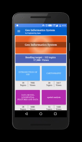
This useful App lists 100 topics with detailed notes, diagrams, equations, formulas & course material, the topics are listed in 5 chapters. The app is must have for all the engineering science students & professionals.
The app provides quick revision and reference to the important topics like a detailed flash card notes, it makes it easy & useful for the student or a professional to cover the course syllabus quickly just before an exams or job interviews.
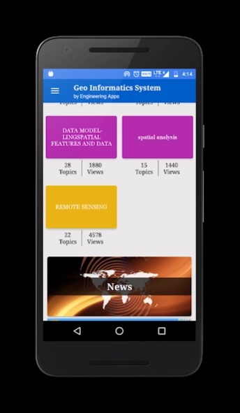
Also get the hottest international engineering & technology news on your app powered by Google news feeds. We have customised it so that you get regular updates on the subject from international/national colleges, universities, research, industry, applications, engineering, tech, articles & innovation.
This is the best application to remain updated on your fav. subject.
Use this useful engineering app as your education tool, utility, tutorial, book, a reference guide for syllabus and explore study course material, aptitude tests & project work.
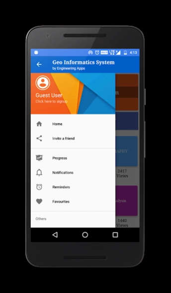
Track your learning, set reminders, edit, add favourite topics, share the topics on social media.
Some of the topics Covered in this application are:
1. INTRODUCTION OF GIS
2. GIS to Geocomputation
3. Technological Facilitation
4. BASIC FUNCTIONALITY OF GIS
5. A SYSTEM DEFINITION OF GIS
6. GIS Science and the Rise of Geo-Information Engineering
7. GIS SCIENCE TO FOLLOW
8. ISSUES OF GISCIENCE AS SELECTIVE GROUPING OF ASPECTS
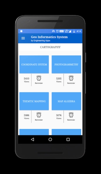
9. INTRODUCTION OF CARTOGRAPHY
10. GEOINFORMATION TECHNOLOGY AND CARTOGRAPHY
11. COORDINATE SYSTEM
12. GLOBAL SYSTEMS
13. PROJECTION BASICS FOR GIS PROFESSIONALS
14. MAP SCALE
15. MAP PROJECTION
16. GEOMETRIC TRANSFORMATION
17. VECTOR AND RASTER DATA
18. SAPATIAL PHENOMENON OF GIS
19. SPATIAL DATA FUNCTION
20. DATA COLLECTION TECHNOLOGIES
21. REMOTE SENSING
22. GROUND SURVEY
23. The Role and Nature of Environmental Models
24. CONTEXT OF ENVIRONMENTAL MODELLING
25. A SUMMARY OF MODEL DEVELOPMENT
26. APPLYING MODELS
27. MODELLING LANDSLIDES
28. MODELLING TOPOGRAPHY
29. TYPOLOGY OF MODELS
30. APPROACHES TO MODELLING
31. REPRESENTATION AND COMPUTATION OF GEOGRAPHIC DYNAMICS
32. TEMPORAL MODELLING
33. TEMPORAL GIS
34. DATABASE CONCEPTS
35. DATABASE DESIGN
36. DATA INPUT TECHNIQUES
37. DATA ENCODING
38. GLOBAL POSITIONING SYSTEM(GPS)
39. COMPARISON OF ENCODING AND DECODING
40. MAP LAYOUTS
41. MAP LAYOUTS ELEMENTS
42. COMPLETING MAPS AND SEQUENCES
43. SEQUENCING TECHNOLOGIES
44. MAPPING TECHNOLOGY
45. EVALUATING MODELS
46. MAP ALGEBRA
47. MAP ELGEBRA INPUT TYPES
48. OVERLAY ANALYSIS
49. VECRTOR AND RASTER OVERLAY
50. TARAIN MODELLING
51. SPATIAL INTERPOLATION
52. TRANSFER FUNCTION
53. GIS & ARTIFICIAL NEURAL NETWORKS
54. NETWORKS
55. GIS AND NETWORK ANALYSIS
56. WATER RESOURCE APPLICATIONS OF GIS
57. HYDROLOGIC MODELLING
58. GIS AND SOCIETY
59. GIS AND TRANSPORTATION
60. GIS BASED ASSESSMENT OF GEOTECHNICAL CHARACTIRISTICS
61. GEOTECHNICAL STRUCTURES
62. SPATAIL DATA GENERILAZTION IN GIS
63. WEB MAPPING
64. IMPORTANCE OF WEB BASED DESIGN
65. ENVIRONMENTAL IMPACT ANALYSIS
66. MAP SERVICE
67. ESTABLISHMENT AND DEVELOPMENT OF EFA MONITORING SYSTEMS
68. GIS IN UTILITY MANAGEMENT
69. THEMTIC MAPPING
70. Restructured-Accelerated Power Development and Reforms Programmed
71. GIS IN UTILITY MANAGEMENT
72. THEMTIC MAPPING
73. Restructured-Accelerated Power Development and Reforms Programmed
74. PHOTOGRAMMETRY
75. MOBILE MAPPING
Each topic is complete with diagrams, equations and other forms of graphical representations for better learning and quick understanding.
GIS is part of Civil & other engineering education courses and technology degree programs of various universities.
About Geographic Information System
Geographic Information System is a free app for Android published in the Teaching & Training Tools list of apps, part of Education.
The company that develops Geographic Information System is Engineering Apps. The latest version released by its developer is 5.4.
To install Geographic Information System on your Android device, just click the green Continue To App button above to start the installation process. The app is listed on our website since 2018-01-05 and was downloaded 8 times. We have already checked if the download link is safe, however for your own protection we recommend that you scan the downloaded app with your antivirus. Your antivirus may detect the Geographic Information System as malware as malware if the download link to com.faadooengineers.free_geoinformaticssystem is broken.
How to install Geographic Information System on your Android device:
- Click on the Continue To App button on our website. This will redirect you to Google Play.
- Once the Geographic Information System is shown in the Google Play listing of your Android device, you can start its download and installation. Tap on the Install button located below the search bar and to the right of the app icon.
- A pop-up window with the permissions required by Geographic Information System will be shown. Click on Accept to continue the process.
- Geographic Information System will be downloaded onto your device, displaying a progress. Once the download completes, the installation will start and you'll get a notification after the installation is finished.
